Hiking the Morgan Bay Cliffs to Double Mouth Nature Reserve
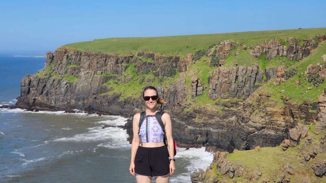
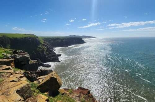
The Morgan Bay Cliffs are located along the stunning Wild Coast in South Africa’s Eastern Cape Province, about an hour’s drive from East London. Shaped by centuries of waves crashing against the rock, these cliffs are a breathtaking and iconic feature of Morgan Bay. They extend all the way to Double Mouth Nature Reserve, offering a variety of activities such as watching sunsets and thrilling abseiling adventures. Popular among both locals and visitors, hiking the Morgan Bay Cliffs is a highlight. Read on to find out everything you need to know about the hike from Morgan Bay to Double Mouth Nature Reserve.
Important Information about the Morgan Bay Cliffs
- Where to begin: You can get to the start of the cliff trails in just a 5-10 minute walk from the Mitford Hotel in Morgan Bay. There’s a parking area across from the hotel where you can safely leave your car for the day.
- Cost: It is absolutely free to hike the cliffs
- Good to know: Pack sunscreen, a hat, and plenty of water. The cliffs are completely exposed so the summer sun can be relentless!
- How long does it take? The time it takes to explore the cliffs varies based on your walking pace and how much time you want to spend. If you enjoy taking it slow, especially for photography, it could take even longer. Personally, I prefer a leisurely pace, soaking in the scenery, lingering, and capturing lots of photos. On average, the longer 11km round-trip hike to Double Mouth takes about 4-6 hours, while shorter hikes will be quicker. Even if you’re just taking a leisurely stroll to see the cliffs, you might end up spending more time than expected, though. Given this, I suggest setting aside a whole day to explore the cliffs because they’re really amazing, and you might regret not having more time!
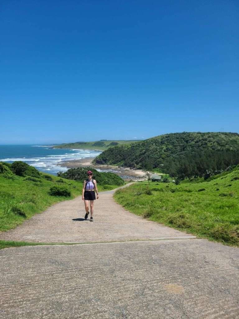
So, where do the hiking trails along the Morgan Bay Cliffs actually start?
To start the trails, simply head west from the parking area in front of the Mitford Hotel and keep an eye out for the trail signboard ahead.

You’ll spot the trail’s official beginning marked by a signboard. This board offers helpful details about the different routes along the cliffs. You’ll have three choices: a 4km, 6km, or 8km hike, each with its own level of difficulty and distance.
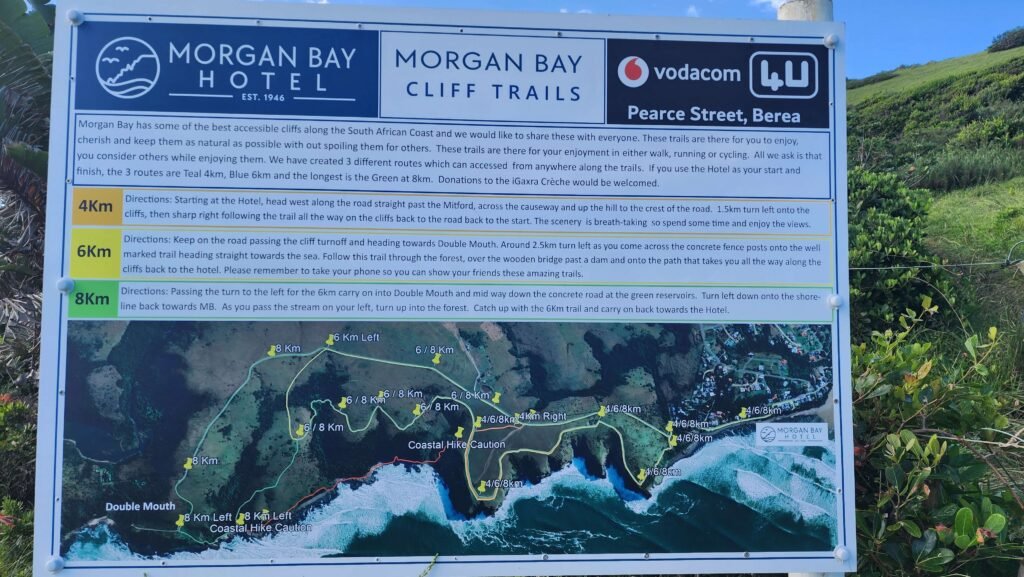
- Easy Trail (4km): This trail is designed for beginning or those looking for a more leisurely walk. The trail also has a minimal elevation gain. The path provides a relaxed and enjoyable experience, allowing you to appreciate the beauty of the Morgan Bay Cliffs at a comfortable pace.
- Moderate Trail (6km): Intermediate hikers and those seeking a bit more challenge will find this trail ideal. It has a moderate elevation gain and covers a longer distance compared to the easy trail.
- Challenging Trail (8km): For fit hikers or those seeking a more strenuous adventure, the challenging trail is perfect. The path includes a steep ascent, uneven terrain, and is a longer distance. It does require a higher level of fitness and stamina.
After some consideration, we settled on the 8km route. However, we made a small adjustment: we included a detour through the river at the Double Mouth Camping site to visit Bead/Treasure Beach. This brought our total round-trip distance to about 10-11km.
Hiking the Morgan Bay Cliffs: The 8km trail to Double Mouth
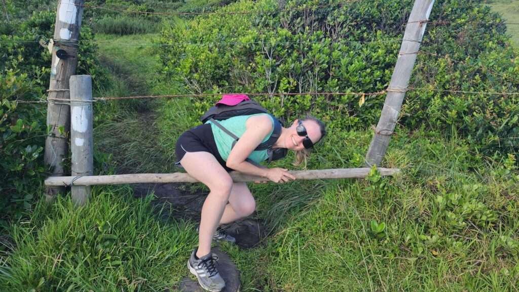
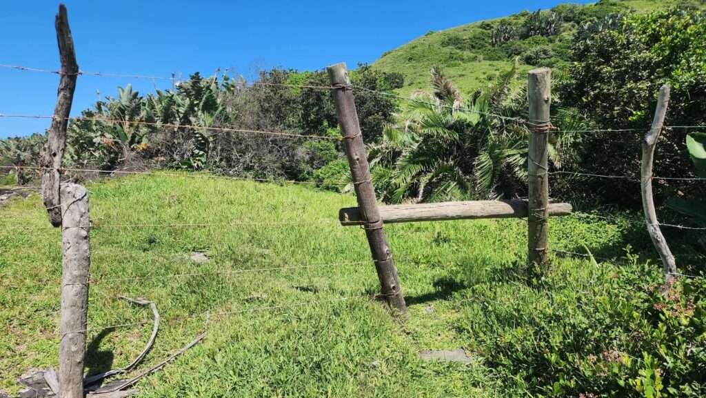
At the beginning of the route, we squeezed through the fenced area and then made our way up the cliffs.
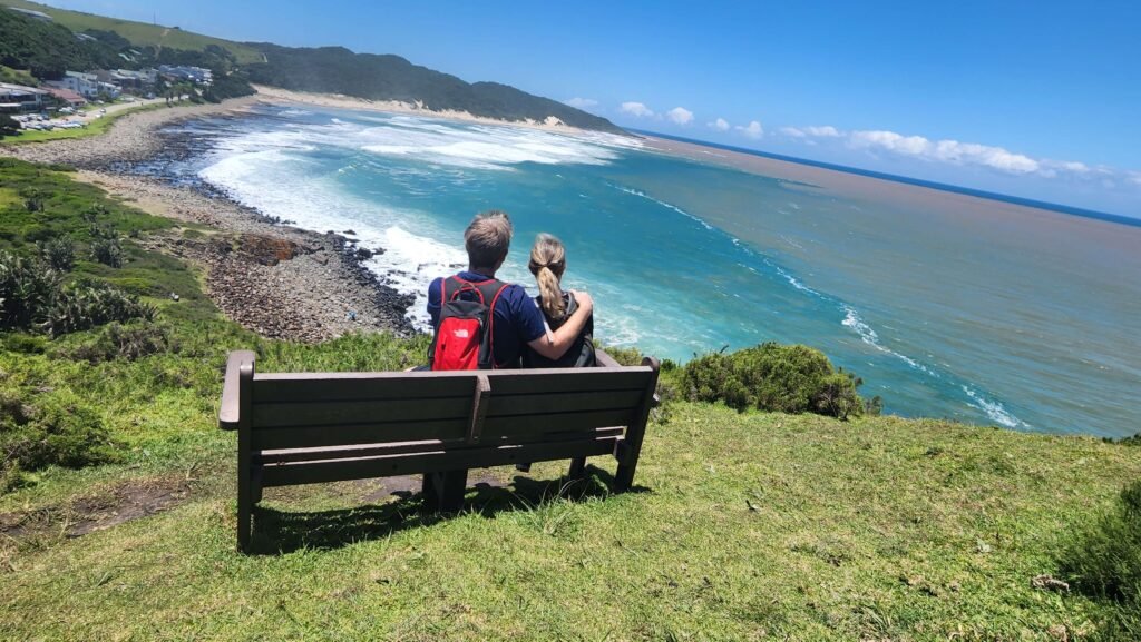
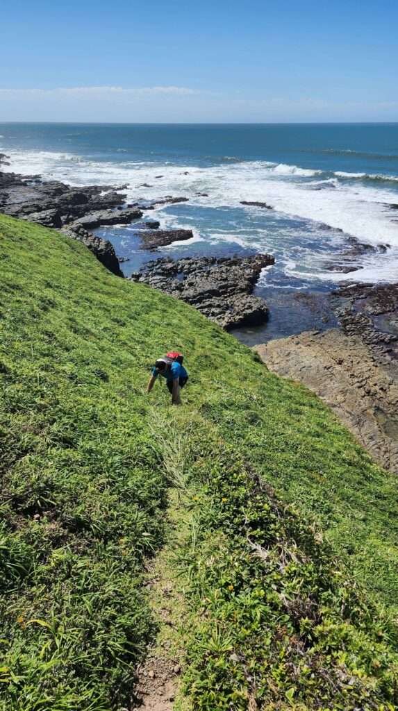
The views are great from the get-go. Along the way, you’ll also find a couple of nice spots to take a break, with benches overlooking the ocean.
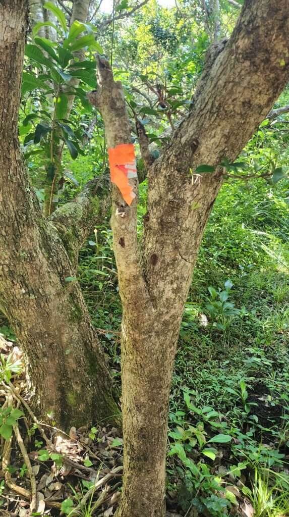
Look for the colored footprints along the path. Each route is labeled with a helpful color code (the 8km route is marked in green), so simply follow the color that corresponds to your chosen path.

We walked for about 2 hours until we reached the last cliff. Here, you enter a forested area. The shady trees and gentle breeze give you a refreshing break as you keep going on the trail.
Bright markers along the way continue to show you’re on the right track.


As you make your way down through the forest, you’ll come to a clearing and catch sight of the ocean ahead.

Next, turn right and follow the rocky terrain along the coastline. Continue on, and you’ll come across another fence. The path beyond that fence will lead you to Double Mouth.
Be careful of a ‘Wrong Turn’
Keep following the path for approximately 10 meters, but be cautious when you reach the point where the path naturally splits. We mistakenly took the left path, which led to a somewhat challenging descent down the cliff (I don’t recommend this route if you have any knee problem or are travelling with young children).

If we had continued on the right fork here, the pathway would have led us up the hill and connected with the main tarred road above, which gently slopes down to Double Mouth Nature REserve.
Anyway, I’ll keep explaining the directions we followed, which involved taking the left path at the fork. We continued walking along the rocks toward Double Mouth River. In the end, we completely missed the main tarred road and the entrance station/hut for Double Mouth Nature Reserve.

Double Mouth Nature Reserve
We kept walking carefully along the rocky shore. Then, around a bend, we came across a steep cliff that surprised us. Getting down required some scrambling. At first, we thought it was part of the trail, but later we realized we had gone wrong. But, we just laughed it off and saw it as a fun part of our adventure.

After we climbed down the cliff, we looked back and saw where we should have been. If we had taken the right path, we would have reached the tar road above. Then, it would have been an easy walk past the hut and signboard to Double Mouth.

Double Mouth – the river crossing
Double Mouth gets its name from a unique feature: where the Umzimvubu River meets the Indian Ocean, forming two separate river mouths.

In order to reach out intended destination, which was Treasure (Bead) Beach, we had to cross the river here. Fair warning, though, you’ll need to be mindful of the tides. When it’s low tide, the river is shallow, just ankle deep. But as the tide comes in, the water level rises quickly. We saw it reach knee depth just an hour after low tide. So, it’s best to check the tide timetable and plan your hike to cross the river at low tide for safety.
Top Tip: Make sure to allow at least 2.5 hours from the trail’s beginning to reach the river and aim for when it’s at its lowest.

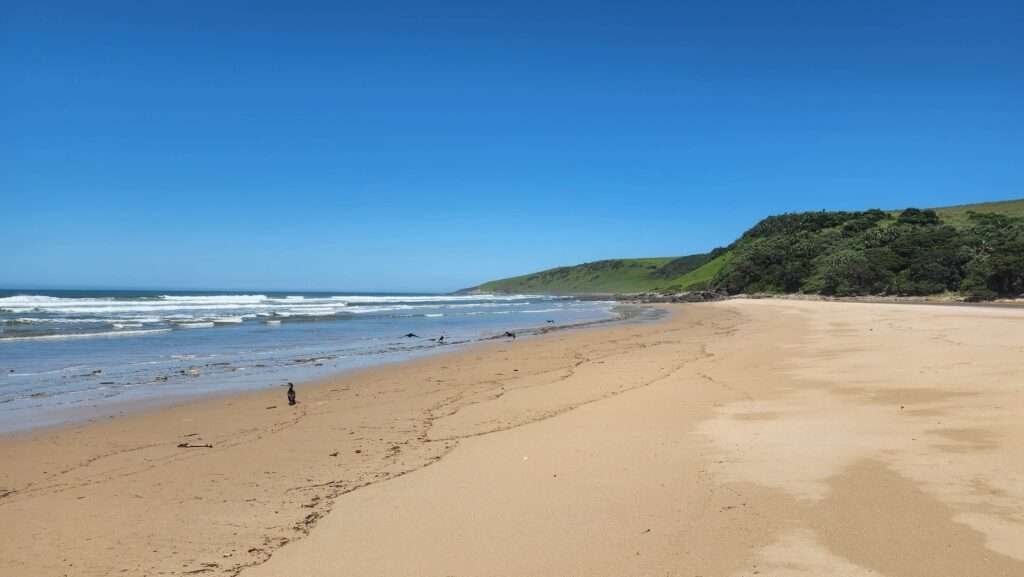
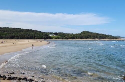
Bead/Treasure Beach
After crossing the river, we made our way to Bead (or, Treasure) Beach. While walking along Bead Beach, pay close attention to the sand and pebbles – you might stumble upon artifacts from a shipwreck. The Wild Coast has a notorious reputation among sailors. Its rough seas, sudden storms, and uncharted coastline have caused numerous shipwrecks and inspired tales of survivors and lost treasure. One such wreck is the Portuguese Santo Espirito, which ran aground in 1608. Although its exact location was not documented at the time, it’s believed to lie offshore of the Double Mouth Nature Reserve, between Morgan Bay and Haga Haga, just north of East London. Today, artifacts like Carnelian beads and pieces of Ming porcelain from the late 16th century wash up on Bead Beach.
Important Information about Double Mouth Nature Reserve
Double Mouth is managed by the Eastern Cape Parks and Tourism Agency, and day visitors are asked to contribute a small conservation fee, which can be paid with either card or cash. As of November 2023, the fee is R26 for adults and R16 for children aged 2 to 11 years.

The Road back to Morgan Bay
After exploring Bead Beach and crossing the river, we retraced our steps along the road to the cliffs and then carried on to Morgan Bay. The return journey includes some uphill sections, so it’s important to have a reasonable level of fitness. Climbing uphill under the midday sun was a bit challenging. However, the incredible views of the cliffs and the ocean made it all worthwhile.
To sum it up, hiking the Morgan Bay Cliffs is a fantastic chance to experience the rugged beauty of the Wild Coast. Remember to be mindful of the environment, leaving only footprints behind. By respecting nature, we can ensure that future generations can also enjoy the splendor of this unspoiled coastal landscape.


You May Also Like
Outstanding destinations in the Eastern Cape
Why East London is South Africa’s most Underrated Coastal Gem