
Panorama Route, A Three Hour Stopover
What exactly is the Panorama Route?
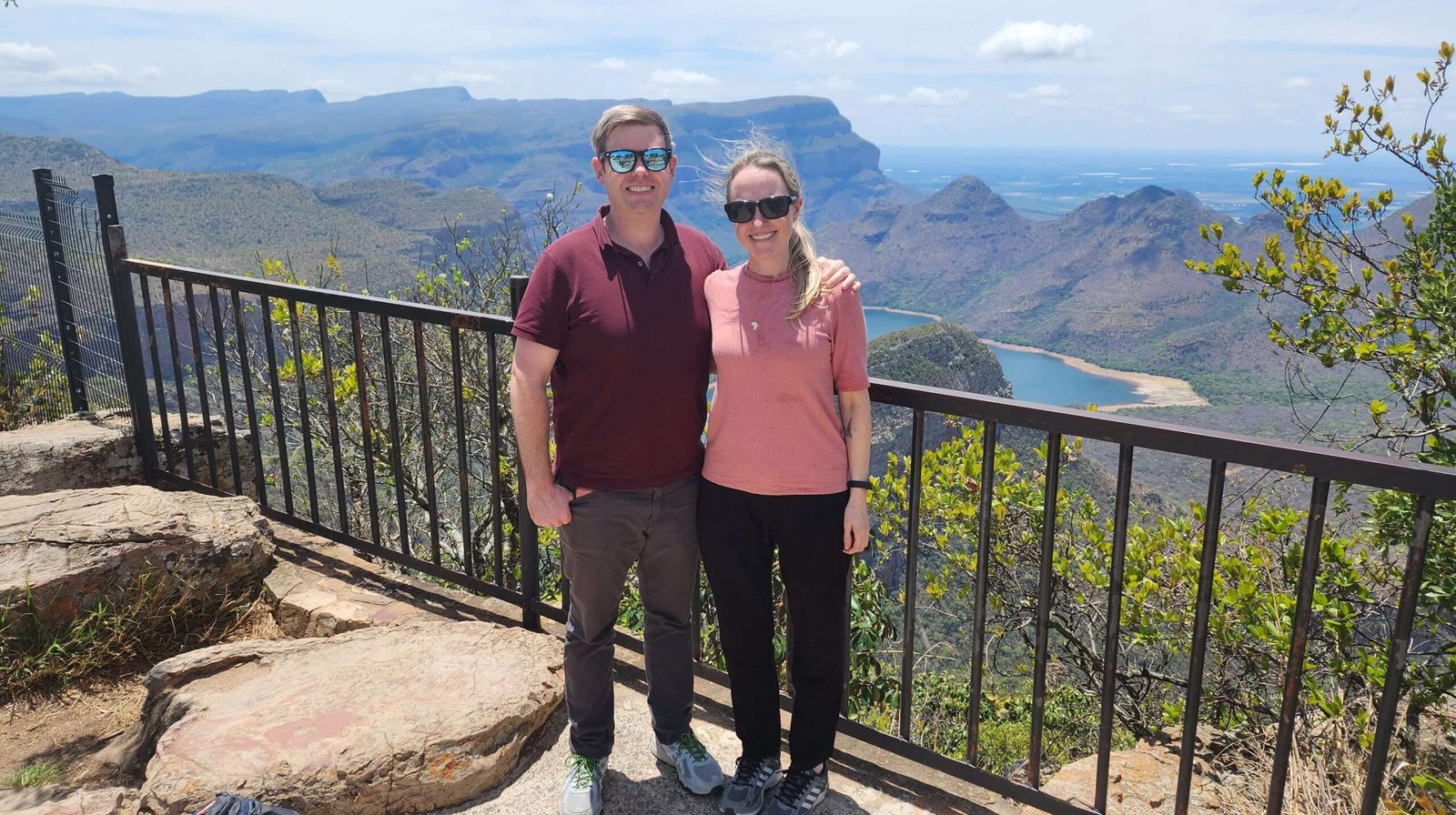
The scenic Panorama Route stretches for 160 km across Mpumalanga province in South Africa, surrounded by the stunning Drakensburg mountains. While it’s possible to explore the top attractions in a single day, I personally encourage a slower pace. Therefore, I suggest allocating 2-3 days to fully soak in the experience, provided you have the time and flexibility. Regrettably, our schedule didn’t permit this luxury, limiting our visit to just 3 hours in the area.
Furthermore, due to its close proximity to the Kruger National Park, the Panaroma route is often combined with a trip to Kruger, which is exactly what we did during our four day tour of the Kruger.
The Blyde River Canyon
The route is centered around the Blyde River Canyon, now officially known as the Motlatse Canyon. An area of astounding beauty, the Blyde River Canyon gets its name from the Dutch word for ‘happy’, which is Blyde. So, directly translated, Blyde River Canyon means ‘Happy River Canyon’. Unlike other canyons, the Blyde River Canyon is considered the greenest canyon in the world due to its subtropical vegetation.
What is there to see at the Blyde River Canyon?
The canyon is a spectacular area, rich in natural wonders. The canyon is a stunning place with lots of natural beauty. It has unique rocks, waterfalls, and great views of the canyon from various points. Even though we only saw a small part of what the Blyde River Canyon has to offer, we visited three popular places: The Three Rondavels, Bourke’s Luck Potholes, and God’s Window.
The Three Rondavels
Situated on the edge of the Blyde River Canyon, it’s hard to miss the three pronounced rock formations in the distance. The rocks attribute their name to the similarity they have with a traditional circular African dwelling, otherwise known as a rondavel.
As you walk, be on the lookout for small wildlife in the area, especially the colorful lizards lounging on the rocks.

How did the Three Rondavels get their interesting shape?
These geological formations, which formed naturally by erosion, have fascinated people for years. The softer underlying stone, eroded and washed away by weather, gave way to the harder slate and quartzite, which formed the distinctive shapes we see today. In addition to their geological wonder, they also have an interesting story to their alternate name.
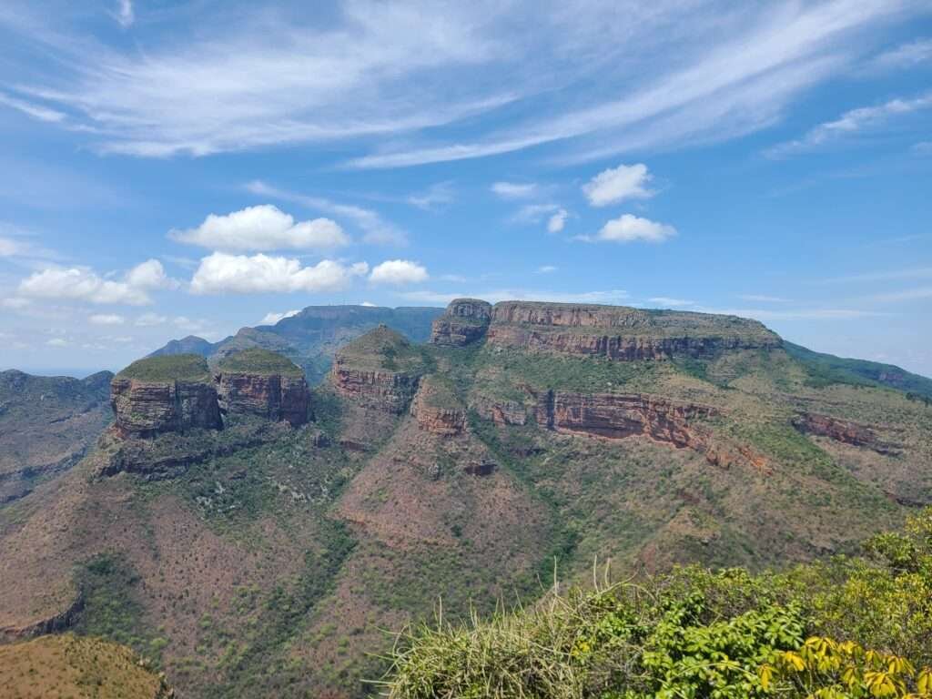
The story of the Three Rondavels
The rondavels are sometimes referenced to as “The Chief and his Three Wives”. The flat topped peak is named after the legendary chief, Maripi Mashile. This well-known chief won a great battle against the Swazis, a rival ethnic group. Subsequently, the remaining peaks are named after his three wives – Magabolie, Mogoladikwe, and Maseroto.
We spent about 30 minutes admiring the view and looking out over the pristine landscape. After spending a sufficient amount of time there, we moved on to the next stop: Bourkes Luck Potholes
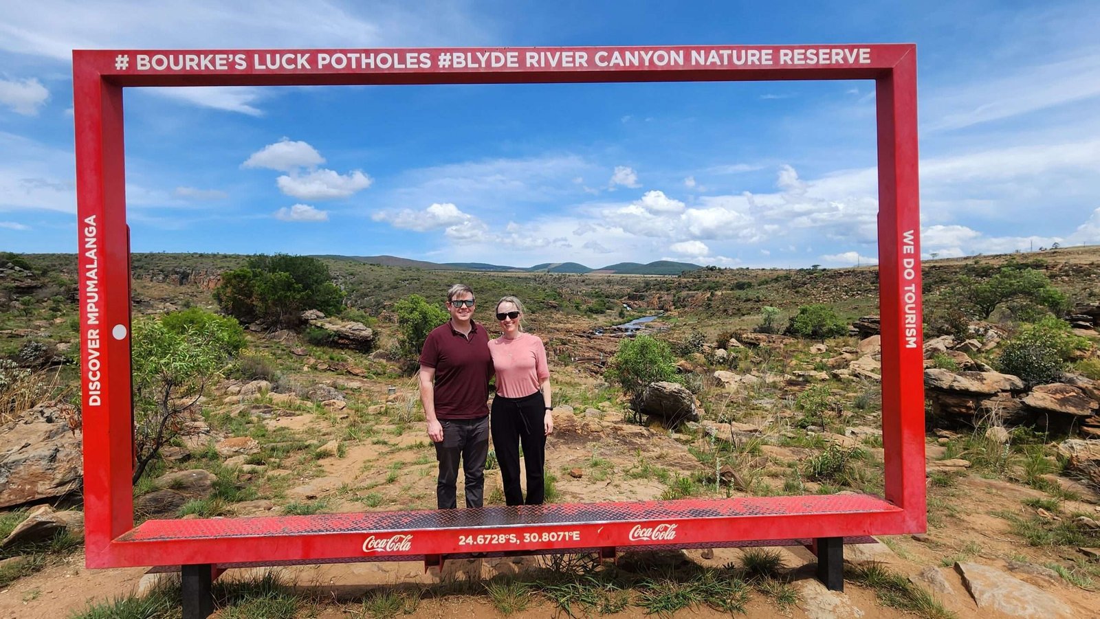
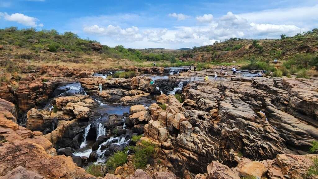
Bourkes Luck Potholes
How did this region of the Panorama Route get its name?
Potholes: The site marks the spot where two rivers, the Blyde River (river of happiness) and Teure River (river of sorrow) converge to form this incredible geological formation. Over the years, water erosion at this spot resulted in the unique cylindrical holes, or ‘potholes’ forming.
Bourke: The ‘Bourke’ part of the name comes from a prospector, Tom Bourke. He proclaimed that the region had gold deposits and staked a claim in the area. Unfortunately, he misjudged the region and never did find gold. As a result, his ‘luck’ ran out so to speak.
What can you do at Bourke’s Luck Potholes?
We spent about an hour walking around the area, marvelling at the rock formations and pristine environment. The walk around the area is easy and has numerous safety rails. In addition, there are also a couple of bridges with great views of the potholes. It’s really up to you how long you spend in the area, but I would recommend at least an hour to properly explore and enjoy it.
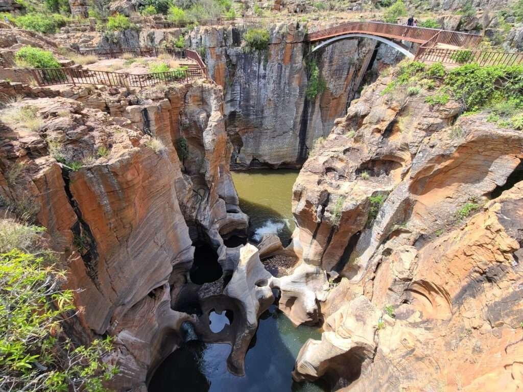
Furthermore, there are also some cool and refreshing pools around the potholes where you can dip your feet.

God’s Window
How did God’s Window get its name?
God’s window was originally named after a rectangular hole in a rock that looks out into the distance. The new site, further along the mountain, offers the same breath-taking views. After a 0.6 mile trail through the forest, you arrive at the main lookout point for God’s Window.
What can you do at God’s Window?
A small trail through the forest takes you via two view points towards the peak, where you get a panoramic lookout on to the landscape. The view is spectacular and on a clear day, Kruger National Park can be seen in the distance.
An hour at God’s Window should give you enough time to take a moment to embrace and photograph each scenic view point.

It is extremely difficult to capture the beauty of the Panorama Route through photographs. The lens just doesn’t do the area justice. The only way to really ‘feel’ the area is to experience it yourself.
The map below shows our main points of travel during this trip.
In conclusion, the Panorama Route is a must see destination on any tour of South Africa. Often paired with a trip to the Kruger National Park, you will not be disappointed!

Author: Samantha


10 Comments
Steve
On our want to Kruger, we took the time to enjoy Blyde River Canyon… and you are right – pictures don’t do it Justice. It was mid-January and we experienced a day of light rain, the views were amazing. Unlike the Grand Canyon in the United States where the canyon is all rock, here the vegetation adds a level of beauty that is special to see.
Samantha
Thank you for the comment, Steve! Glad you guys are having such a lovely time. Hope you see lots of animals in Kruger, too 🙂