Salt River Mouth Hike in Natures Valley: A helpful guide
Nature’s Valley is a little piece of paradise on South Africa‘s southern coast, right in the heart of the Garden Route. It offers fantastic coastal hiking trails, including the famous 5-day Otter Trail. If long hikes aren’t your thing, though, don’t worry. Nature’s Valley also has shorter day hikes, like the Salt River Mouth Hike, leading to a secluded beach just west of the village center. Since you can only reach it by walking, we were super excited to go and check it out!
Route Options for the Salt River Mouth Hike
There are various ways to reach Salt River Mouth beach, but all trails begin and end at ‘The Blue Rocks Café‘ on the westernmost side of Nature’s Valley.
[ROUTE 1, CIRCULAR]: Start by heading west from the beach for about 3 minutes until you spot the entrance sign to the forest. Follow the forested path uphill to a lookout point, then descend to the salt river mouth. Trace the coastline back to the starting point.
[ROUTE 2, CIRCULAR]: Walk west from the beach, past the forest entrance, and follow the coastline trail to the salt river mouth. Next, ascend into the forest trail, reaching a lookout point. Finally, follow the forest trail back down to Nature’s Valley main beach.
[ROUTE 3, LINEAR]: Enter the forest from the beach and walk up to the lookout point or as far as you’d like. Return the same way you came.

Technical Information about the hiking trail
- DURATION: 2-3 hours (potentially longer if you choose to spend extra time exploring the Salt River Beach, including its rock pools).
- DISTANCE: 3.6 km
- DIFFICULTY LEVEL: The trail is moderately challenging, featuring some brief steep climbs and tricky coastal sections that require careful footing. A short 30-meter stretch might pose challenges for individuals with knee or ankle issues or a fear of heights. Extra caution is advised when the coastal rocks are wet and slippery.
A helpful guide to hiking the Salt River Mouth Trail
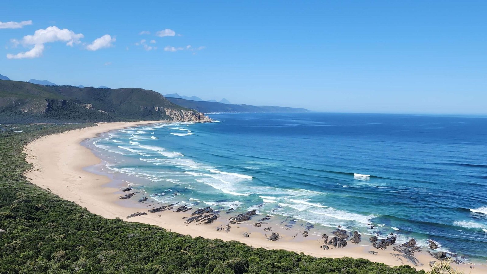
The coastal section
Note: We opted for ‘circular route 2.’ So, instead of starting in the forest from the beach, we walked along the coastline all the way to the Salt River Mouth. Then, we climbed up through the forest, making our way back to the starting point at the Blue Rock Cafe.
As a starting point, park your car or start walking near the Blue Rocks Café. Follow a short boardwalk path next to the public toilets – it’s your route to the stunning Nature’s Valley Beach.
Afterwards, take a right (head west) once you reach the base of the stairs leading to the beach.

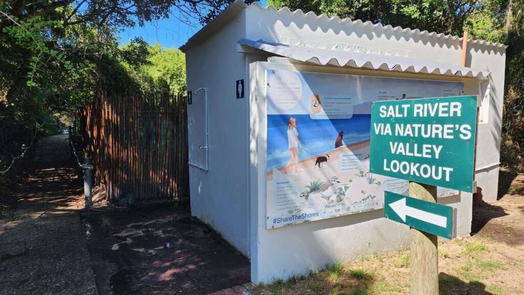
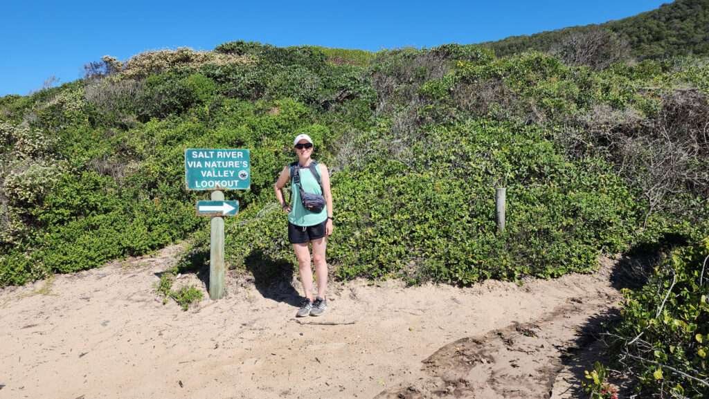
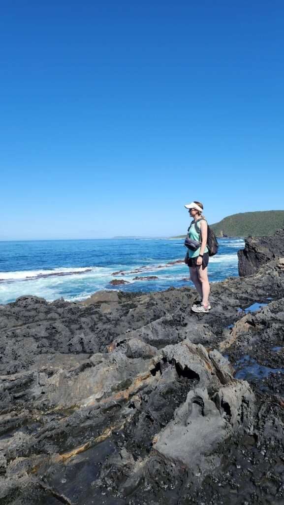
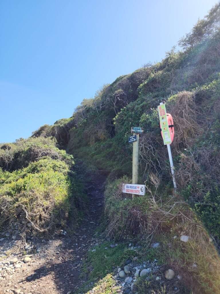
A lot of people start the forest trail at the salt river via natures valley lookout sign (see the picture below). However, if you’re on circular route 2 like us, simply keep going along the coastline instead of entering the forest at this point.
A short distance after passing the forest entrance, you’ll spot the signs for the beginning of the coastal path.

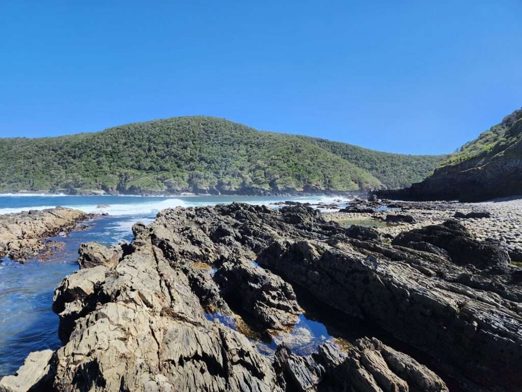
The first 10 minutes of the trail are straightforward, featuring a few rock crossings along the coast. Be on the lookout for whales in the area – you might catch a glimpse if you’re lucky!
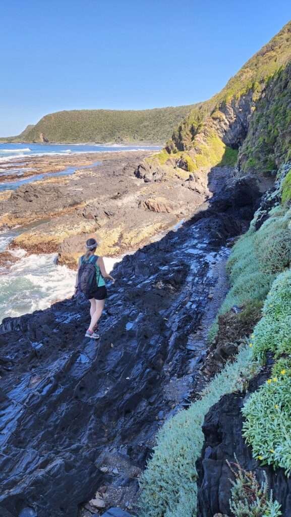
Over the next 10 minutes or so, the coastal path becomes a bit more challenging. This is the part where individuals uneasy about heights might feel a bit apprehensive as they navigate the steep and narrow trail. However, with careful steps, it’s perfectly safe to walk through this stretch.

Eventually you will reach a gulley.
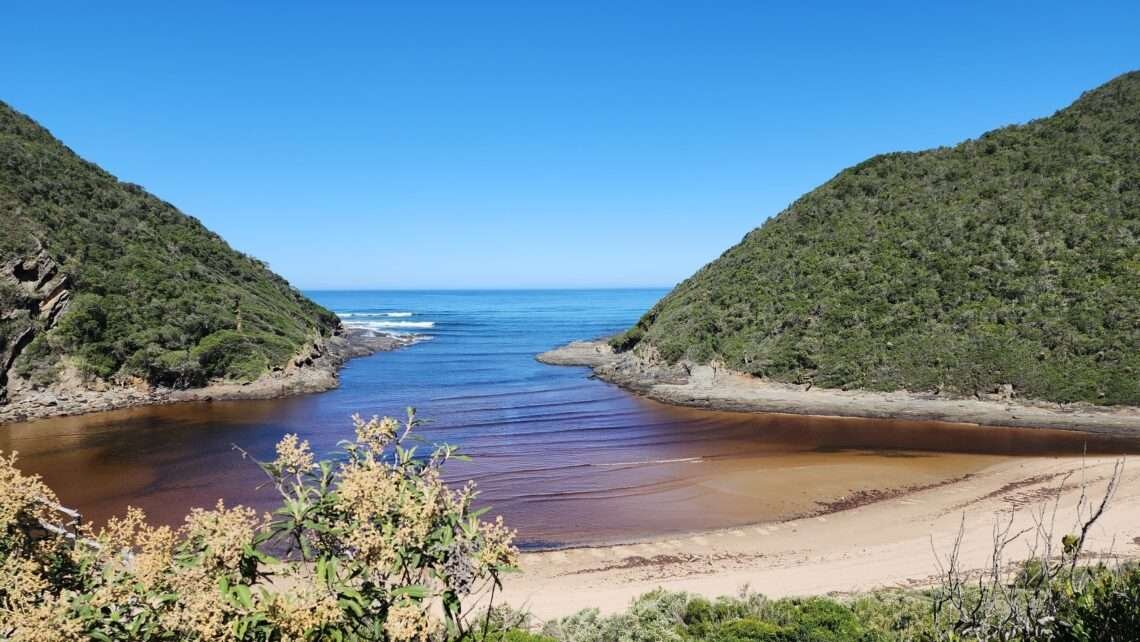
Once you’ve crossed the gulley, keep following the coastline for another 20 minutes or so. Soon, you’ll come across the sign for Salt River Mouth, guiding you away from the coastal path and into the forest.
We didn’t head into the forest right away, though. Instead, we took our time, spending about 15 minutes exploring the rock pools and enjoying the stunning coastal views. The pools are full of interesting creatures and beautiful shells.


The forest section
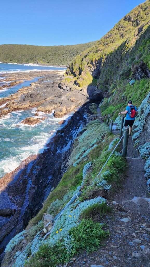
After exploring the pools for a bit, we continued making our way to the Salt River Mouth beach through the forest trail. It’s a short, steep climb for about 3-5 minutes, and then the path winds gently through the forest. Just keep walking straight on this path.
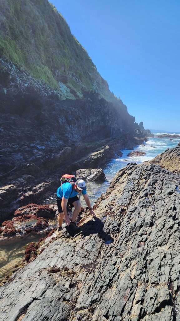
As you keep going, you’ll see two steep slopes with ropes leading to the rocks below. If you’re feeling adventurous (like we were), you can climb down using the ropes. It’s a bit challenging, but fun. The ropes help you go down and back up. Fishermen usually use it, and it’s only a short drop to the rocks.

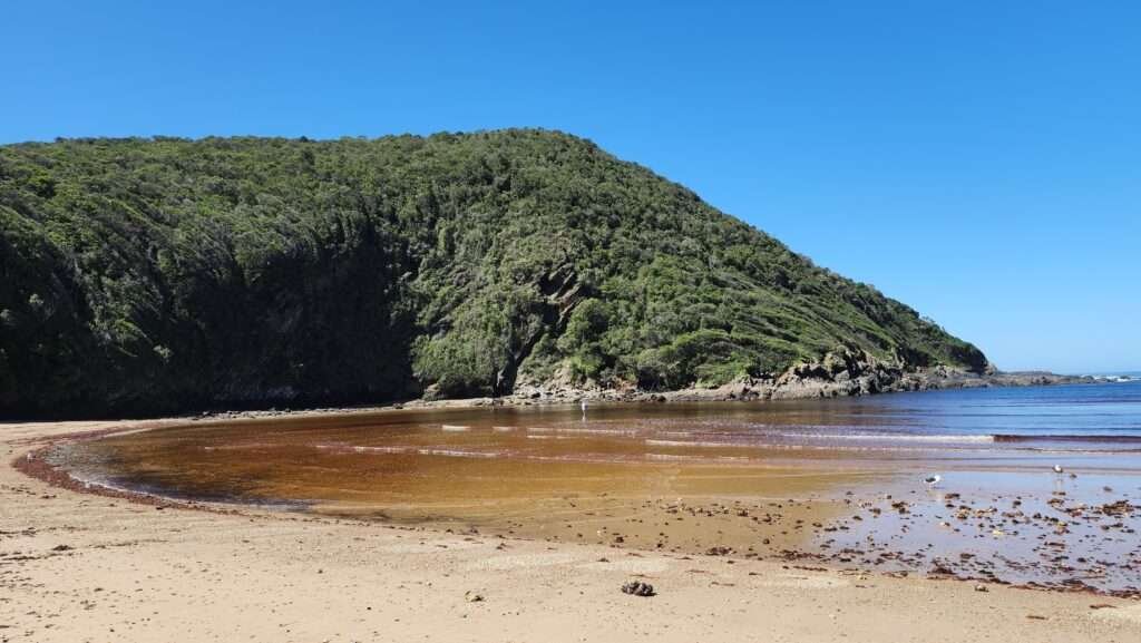
The Salt River Mouth
If you’re not up for climbing down steep slopes with ropes, no worries! Just skip this part. Instead, walk for about 5 minutes through the forest towards the Salt River Mouth. As you walk, you’ll notice the peaceful enclave coming into view below you

The shaded rocks at Salt River Mouth beach is a great place to stop for a picnic before you continue on the trail.
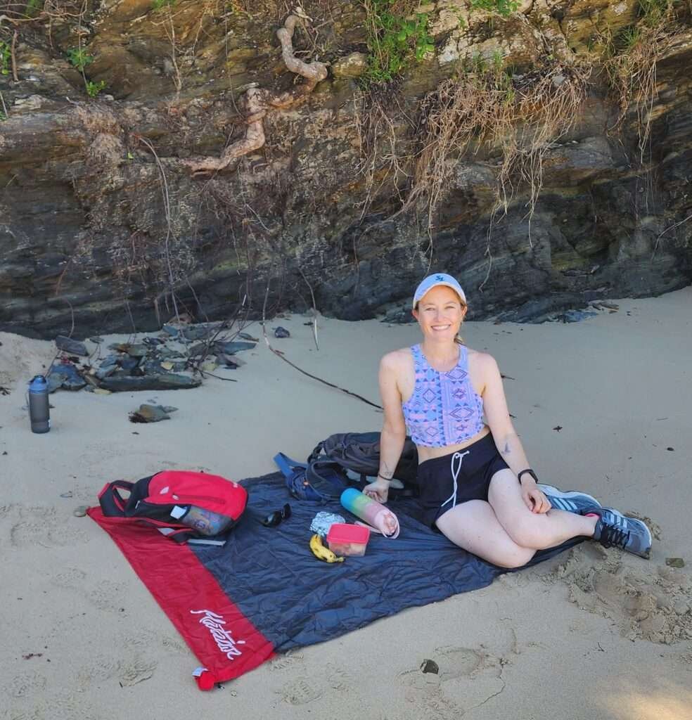
After taking a 30-minute break to relax and snack in the shade, we were ready to continue our hike. Keep an eye out for a clear sign at the beach pointing you toward the forest.

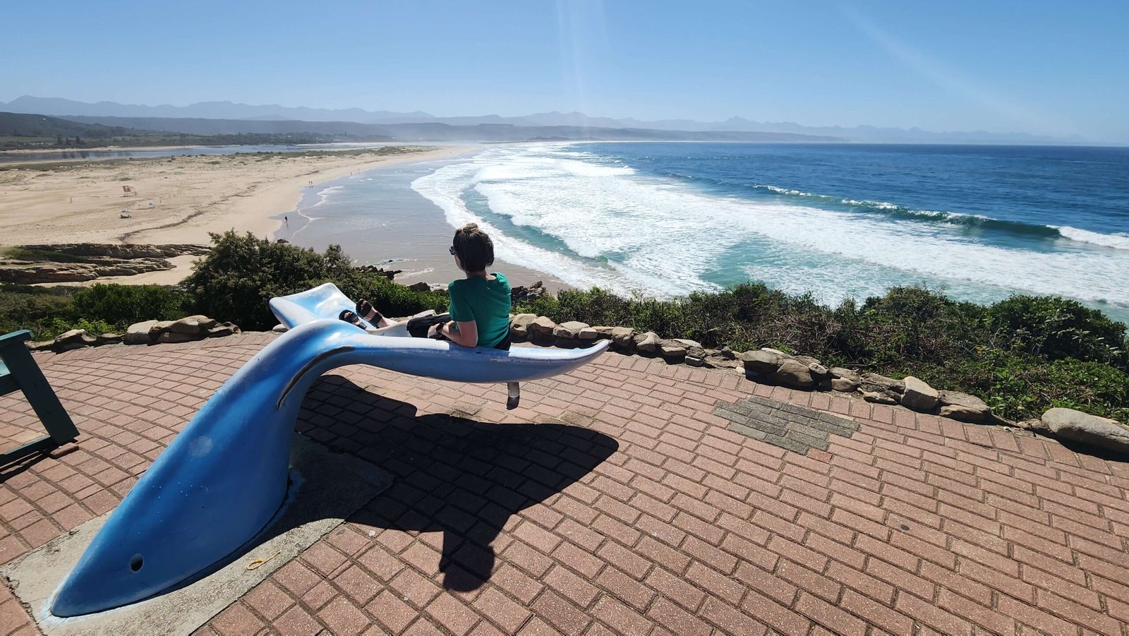
The viewpoints
After going uphill for about 8-10 minutes, the path evens out and starts to gently slope downward. Walk another 5 minutes or so, and you’ll see a short path veering to the edge – that’s the lookout point. It was the best part of the trail for us. The ocean looked amazing with various shades of blue, set against the green mountains and the small town of Nature’s Valley below. It was really a spectacular view!

Once you’ve enjoyed the viewpoint, keep heading downhill and follow the signs guiding you to the beach.

I loved every minute of the Salt River Mouth Hike, and it’s right up there with the Robberg Hiking Trail as one of my favorites in South Africa.
Helpful tips for the Salt River Mouth Hike
- Pack a camera, sunglasses and plenty of sun cream.
- Wear suitable hiking shoes.
- Pack a picnic. It’s so nice sitting at the Estuary and enjoying some snacks!
- To really get the full experience, I strongly recommend doing a circular trail. The scenery is incredible and the extra steps are worth the views.
- Take your time! Although the trail can be done in 2-3 hours, there’s just so much nature and sights to embrace that you will find yourself wishing you had more time.
- It’s advisable to travel with at least one other person. Some of the coastal route is challenging and slippery, so it’s best to have someone there to help in an emergency.
- Take a picture (or save to your phone) the emergency numbers at the start of the trail.
Where to stay in Nature’s Valley
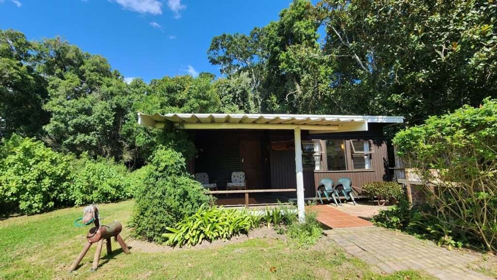
If you’re looking for a place to stay near the Salt River Mouth Hike, your best bet is Nature’s Valley Rest Camp. This is the main accommodation choice in Nature’s Valley Village, offering various self-catering options like chalets and camping facilities. It’s wise to book in advance, especially during busy times. If you want more options, consider checking Google Maps and booking directly with the property. Keep in mind that some places may not be listed on major booking websites.
If you can’t find what you need in Nature’s Valley, explore the Crags region. I highly recommend Natures Way Farm Stay, just a 15-minute drive from Nature’s Valley. It’s on a working farm and makes for a lovely base to explore the area.
For more options, you can also check out places like Plettenberg Bay, just 25km to the west, which offers a variety of accommodations. Heading east, Storms River Village is about 45km away. The village has great accommodation choices, as well as some lovely restaurants and nearby attractions.
Best things to do in Natures Valley
Other hikes in Nature’s Valley & surrounds
Another great hike nearby is the Pig’s Head Trail, on the East side of Nature’s Valley.
Robberg Nature Reserve isn’t too far from Natures Valley either, only a 45km (44 minute) drive in a Westerly direction towards Plettenberg Bay.
The trails at Storms River Mouth are some of my favorite in South Africa. Be sure to check them out here.
Explore the Best of the Garden Route: A Three-week itinerary

Author: Samantha


You May Also Like

Inkwenkwezi Restaurant: An Irresistable Sunday Buffet Spread

Wine, Warmth and Wags: A Special Day at Camberley Wine Estate
